Master Thesis by Fabian von Bechen
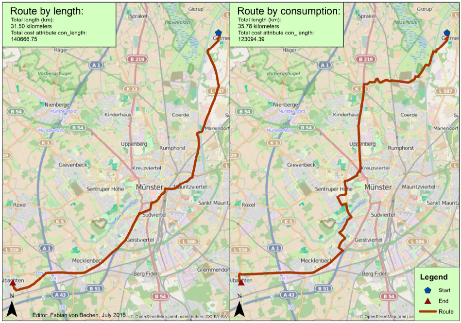
Traffic is one of the biggest sources of CO2 emission in Germany. Research to reduce these emissions focuses on the development of low-emission drive systems or electric engines. Another possibility to avoid CO2 emissions is environmentally friendly routing. Fabian von Bechen took this approach in his Masters thesis “The use of floating car data for cost attributes in routing applications”.
Classic routing services calculate the fastest or shortest routes. This is done with algorithms based on the cost attribute “length of the route” and/or the “permissible speed” on the route. For the most part, this is based on historical data. Actual average velocity can differ. In order to navigate to a destination based on reduced CO2 emissions, a routing application based on a “fuel consumption” cost attribute is required. This cost attribute is the average fuel consumption value of the street segments.
In order to achieve a consumption or emission based routing, Fabian used enviroCar’s anonymous Extended Floating Car data (xFCD) to calculate fuel consumption and derive the CO2 emissions. He developed a Python geoprocessing script using ArcGIS ArcPy to process the data and match the consumption information from enviroCar with the OSM street network. Based on this combined network dataset, a route that saves the most fuel can be generated.
The thesis results in a successful first attempt to calculate the best route with the lowest fuel consumption. However, several factors that also influence the routing have not yet been considered, e.g. the factor time, driving direction in the enviroCar data and personal driving behavior.

Leave a Reply