This year’s AGILE conference (June 14-16, 2023) was hosted by the Technical University of Delft in the Netherlands. 52°North took the opportunity to present recent work on the OGITO project.
OGITO (Open Geospatial Interactive Tool) is a collaborative mapping application for use on digital map tables, originally developed at ITC (Faculty of Geo-Information Science and Earth Observation of the University of Twente). ITC carried out a case study in the city of Zwolle (the Netherlands) with the aim of exploring how a digital planning tool should be designed to enable people with different physical disabilities to participate in urban planning tasks. For this case study, ITC collaborated with 52°North to further develop and adapt OGITO to meet the needs of people with physical disabilities for an inclusive, collaborative mapping application.
Currently, most software applications used in urban planning scenarios are designed for GIS professionals. This also means that often not all stakeholders are able to participate in spatial planning tasks. In particular, people with disabilities should be able to give their opinion on the accessibility of public spaces. In a co-design process involving scientific researchers and a group of eight co-researchers from Zwolle with different physical disabilities (including wheelchair users and people with limited vision or hearing), the requirements for an inclusive mapping application were elicited and the existing OGITO software was adapted accordingly. The co-design was an iterative process involving a series of workshops where the co-researchers tested new versions of the software and provided feedback on its accessibility. Finally, the co-researchers mapped good and bad examples of accessibility in the city of Zwolle using the adapted OGITO software and discussed these observations together with representatives of the city of Zwolle in a final meeting.
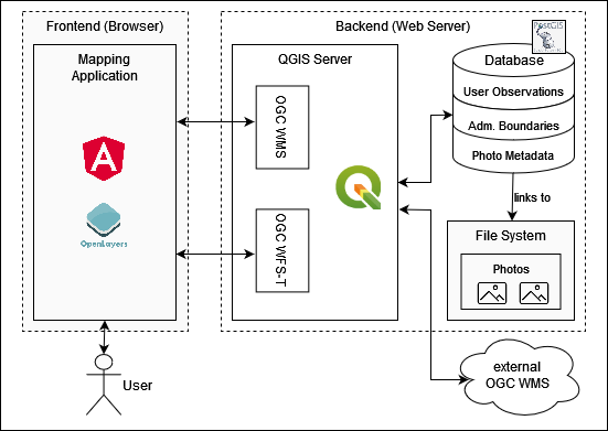
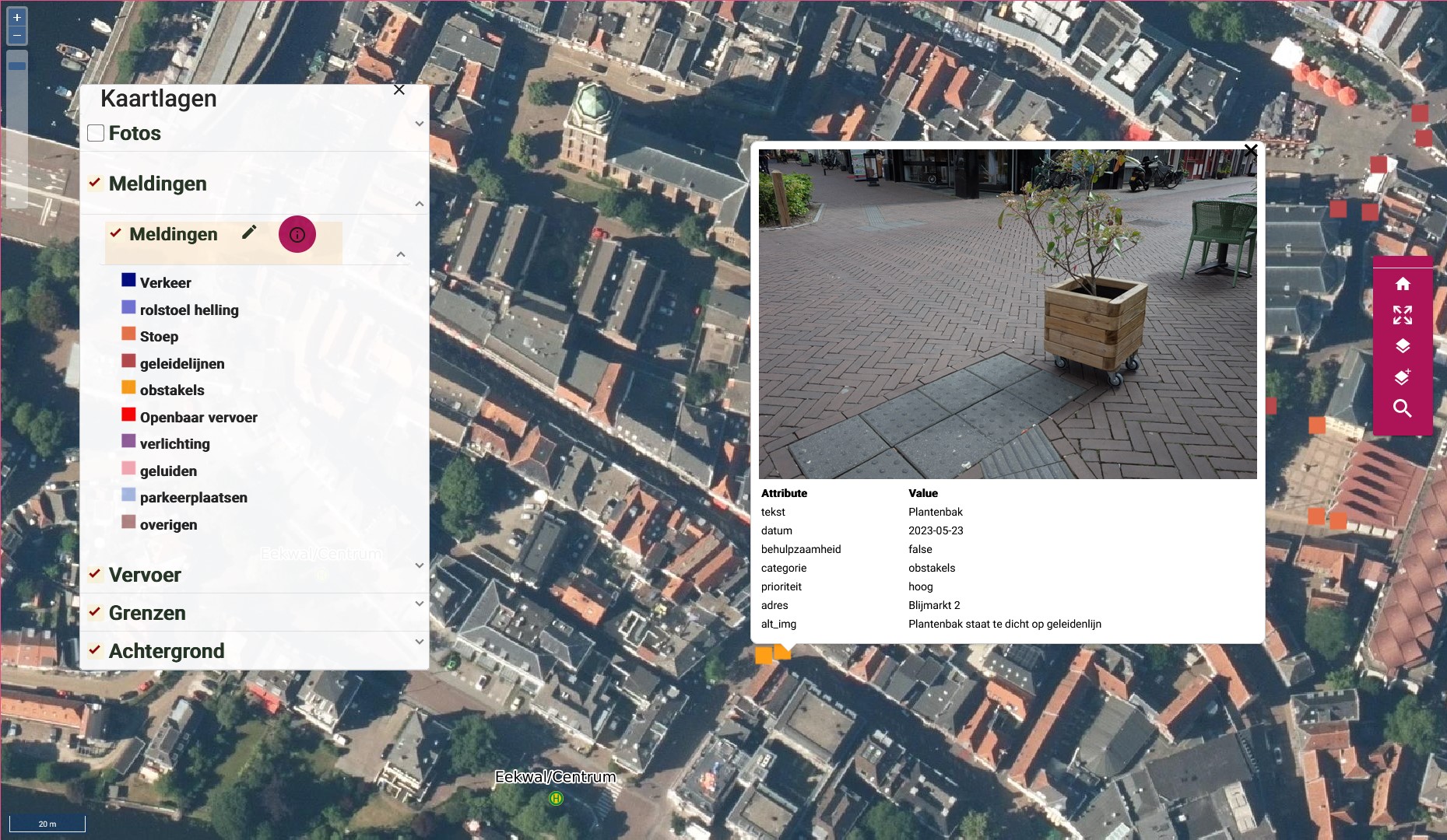
During the co-design process, changes were made to the OGITO software with each iteration. The use of existing open source software allowed for quick adjustments. The first iteration was a basic project setup where testers could select from a few base maps (topographic maps or aerial photographs) and display some additional information, such as municipal and district boundaries. The layout of the user interface was adjusted accordingly. Controls, font size and contrast were increased to help users with limited motor skills or eyesight. The team then added other features to the software. Users can now map accessibility issues in the city. To map the issues, they add a simple marker on the map, select a category (e.g., traffic, noise, obstacle), add a descriptive text, and annotate whether it improves or degrades accessibility. The mapping functionality was later expanded to include an optional photo upload to illustrate the mapped situation. In addition, some convenience features such as a street search (based on OpenStreetMap data) were implemented. The technical framework of OGITO consists of an instance of QGIS Server and a PostGIS database in the server-side backend. The web-based frontend is a single page application built with the widely-used Angular framework. The map visualization and mapping functionality is implemented using the open source Openlayers library. The data exchange between frontend and backend works via standardized web service interfaces such as OGC WMS and OGC WFS-T.


There are several ideas to use and further develop the basic OGITO software in other projects in different domains. For example, the I-CISK research project with its living labs provides an interesting use case for collaborative planning tools, because local stakeholders should be involved in the development of next generation climate services. We hope to present new developments and more use cases of OGITO in the future – possibly at the AGILE 2024 conference in Glasgow.
The short paper submission “Development of an inclusive Mapping Application in a Co-Design Process” for AGILE Conference 2023 is open access: https://doi.org/10.5194/agile-giss-4-48-2023
Leave a Reply