Advancing Spatial Information Research through Open Innovation
In 2026, 52°North celebrates its 20th anniversary. Over the past two decades, the organization has evolved from a small open source initiative into an internationally recognized research and innovation partner for spatial information technologies. Throughout this journey, one principle persists: bridging the gap between research and real-world application by developing innovative geospatial solutions together with partners from academia, industry, and the public sector.
The origins of 52°North date back to 2004, when the Institute for Geoinformatics at the University of Münster and con terra GmbH launched an informal open source initiative. Their vision was to establish a collaborative network that would accelerate the transfer of geospatial research into operational use. By combining scientific excellence with practical software development, the initiative sought to make emerging technologies accessible to practitioners while creating opportunities for collaborative innovation across institutional boundaries.
Among the driving forces behind the initiative were Prof. Ulrich Streit, Dr. Albert Remke, Dr. Adam Sliwinski, Dr. Ingo Simonis, and Dr. Andreas Wytzisk. The network quickly gained momentum. In 2005, the International Institute for Geo-Information Science and Earth Observation (ITC, now part of the University of Twente) joined as a partner. Esri Inc. followed one year later, strengthening the initiative’s links to both international research and industry.
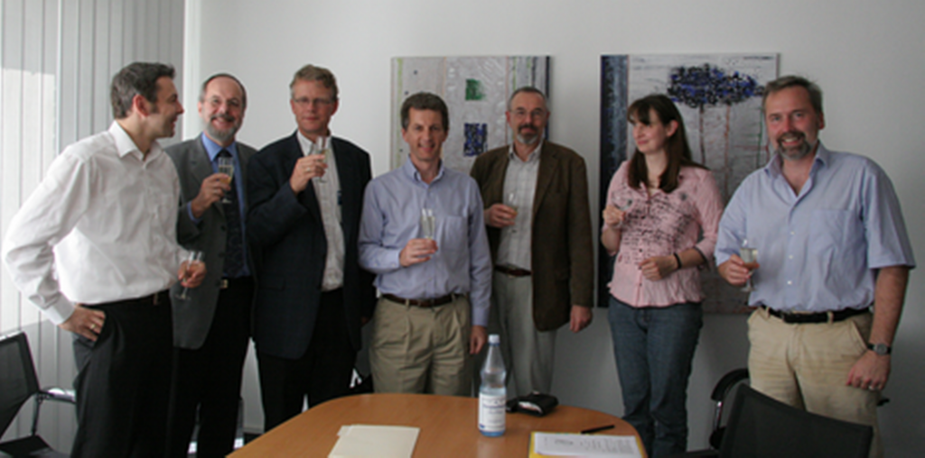
As the initiative expanded, the need for a formal legal entity became increasingly apparent. In September 2006, the 52°North Geospatial Open Source Software Initiative GmbH was established as a non-profit organization. Its founding shareholders – the University of Münster, Esri Inc., con terra GmbH, and ITC – created an institutional framework for coordinating the growing international partner network, supporting collaborative software development, and participating in national and European research and innovation projects.
Initially, many activities were carried out directly by the partner organizations. From 2008 onwards, 52°North established its first permanent positions and began to grow steadily as an independent organization. At the same time, the partner network expanded and matured. Community events, scientific workshops, the 52°North Student Innovation Prize, and successful research projects, including EO2HEAVEN and GITEWS, helped establish the organization as a visible and respected contributor to the international geospatial community.
The period between 2012 and 2020 marked another significant phase of transformation. As cloud computing, collaborative development platforms, and modern software engineering practices fundamentally changed the open source ecosystem, the original role of 52°North as an open source software initiative naturally evolved. At the same time, demand for the organization’s expertise in applied research, technology transfer, and knowledge-intensive geospatial services continued to grow.
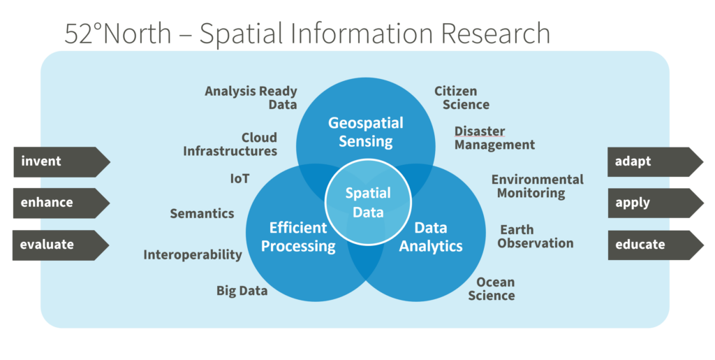
This development culminated in a strategic repositioning in 2020. Guided by the vision of Spatial Information Research, 52°North sharpened its focus on two complementary areas: Applied Research and Knowledge-Intensive Services. As an independent, non-profit research organization, it continues to connect scientific research with operational practice while fostering long-term collaboration across academia, industry, and the public sector. Consistent with its commitment to Open Science, research outcomes are disseminated through scientific publications, open source software, and openly accessible data.
The strategic realignment was accompanied by a generational transition in leadership in 2021. Prof. Dr. Albert Remke and Prof. Dr. Andreas Wytzisk-Arens handed over the management to Dr. Simon Jirka, Dr. Benedikt Gräler, and Matthes Rieke, all of whom already had key leadership roles within 52°North for many years. This transition ensured both continuity and fresh perspectives for the organization’s future development.
Today, 52°North addresses some of the most pressing challenges in the field of spatial information. Its research and innovation activities encompass cloud-native infrastructures for processing large-scale geospatial data in near real-time, machine learning approaches for modelling complex spatial processes, digital twins, and the application of artificial intelligence to improve the discovery, accessibility, and interoperability of geospatial information and spatial data infrastructures.
While technologies and research priorities continue to evolve, the organization’s mission remains remarkably consistent. 52°North is dedicated to transforming scientific knowledge into practical impact by working closely with its partners to develop innovative, sustainable, and openly accessible solutions. With its interdisciplinary expertise, collaborative culture, and strong international network, 52°North is well positioned to help shape the future of spatial information research and to contribute to addressing societal challenges through geospatial innovation in the years to come.
Congratulations on your 20th anniversary, 52°North!
Twenty years of advancing geospatial innovation, open collaboration, and cutting-edge research is a remarkable achievement. We are proud to have been part of this journey from the very beginning and look forward to many more years of successful collaboration.
Happy Anniversary!
Your con terra team