Introduction
Hello everyone!
In my introductory blog post, I introduced my GSoC 2026 project on developing a QGIS plugin for the 52°North Weather Routing Tool (WRT), with the goal of simplifying the existing workflow through an intuitive graphical interface.
It’s now time for the GSoC midterm blog post. Over the past few weeks, the main milestones achieved are the Configuration Wizard and Route Visualization modules. This post summarizes the progress made so far and what’s coming next.
Problem Definition
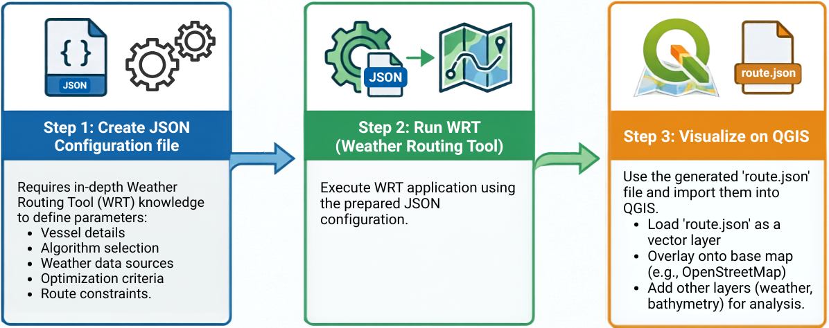
The Weather Routing Tool is a powerful framework, but getting started with it requires users to manually create configuration files, manage datasets, and often read documentation multiple times. While this works well for experienced users, it can make the onboarding process challenging for newcomers and less efficient for those who primarily work in QGIS.
QGIS is a free and open-source Geographic Information System (GIS) that allows users to visualize, analyze, and interact with geospatial data through an intuitive graphical interface.
The objective of this project is to integrate WRT into QGIS, making the routing workflow more accessible to both existing WRT users and newcomers. Instead of manually editing configuration files, users will be guided through an intuitive interface for configuring routing tasks, visualizing datasets, and eventually executing WRT directly within a single application.
Implementation
Configuration Wizard
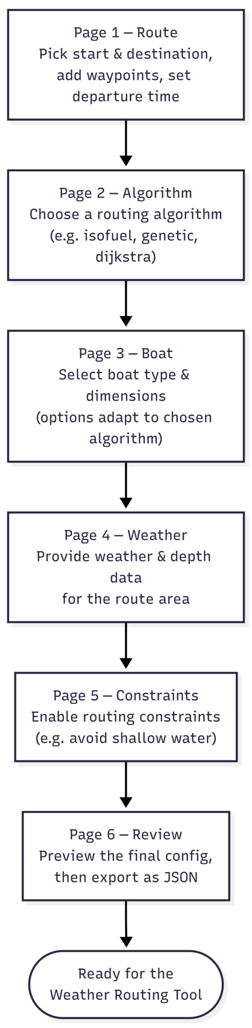
The Configuration Wizard has been the primary focus during the first half of GSoC and is progressing steadily toward becoming the central interface for configuring WRT. Rather than manually editing JSON files, users are guided through a structured workflow where configuration is built incrementally (refer Figure 2). The wizard validates user inputs, adapts to previous selections, and generates the required configuration file automatically.
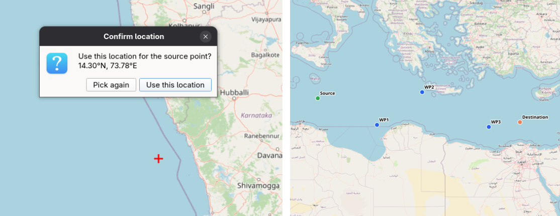
The Pick from Map (refer Figure 3) functionality allows users to select the source, destination, and intermediate waypoints directly on the QGIS canvas. This eliminates the need to manually enter geographic coordinates, making route configuration more intuitive while reducing the likelihood of input errors.
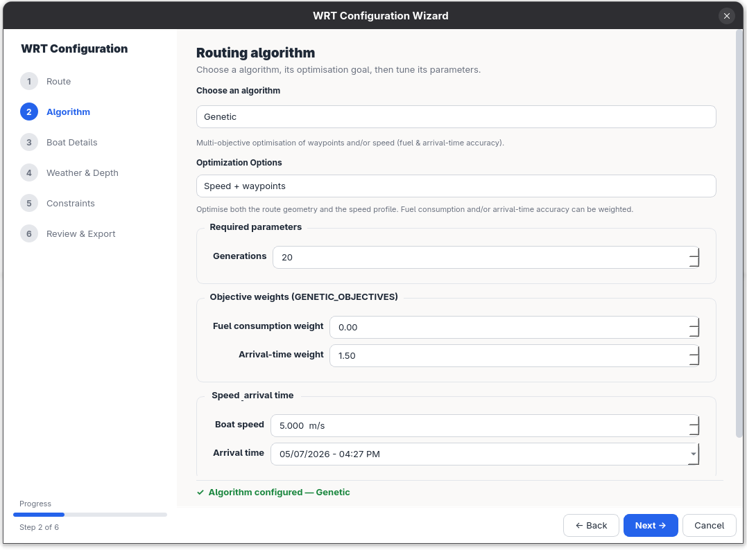
One area that has received particular attention is the Algorithm Selection page (refer Figure 4). The Weather Routing Tool exposes a wide range of algorithm-specific parameters, many of which can be difficult to understand without referring to the documentation. The designed interface presents only the parameters relevant to the selected algorithm while grouping advanced options separately, making configuration significantly easier without sacrificing flexibility.
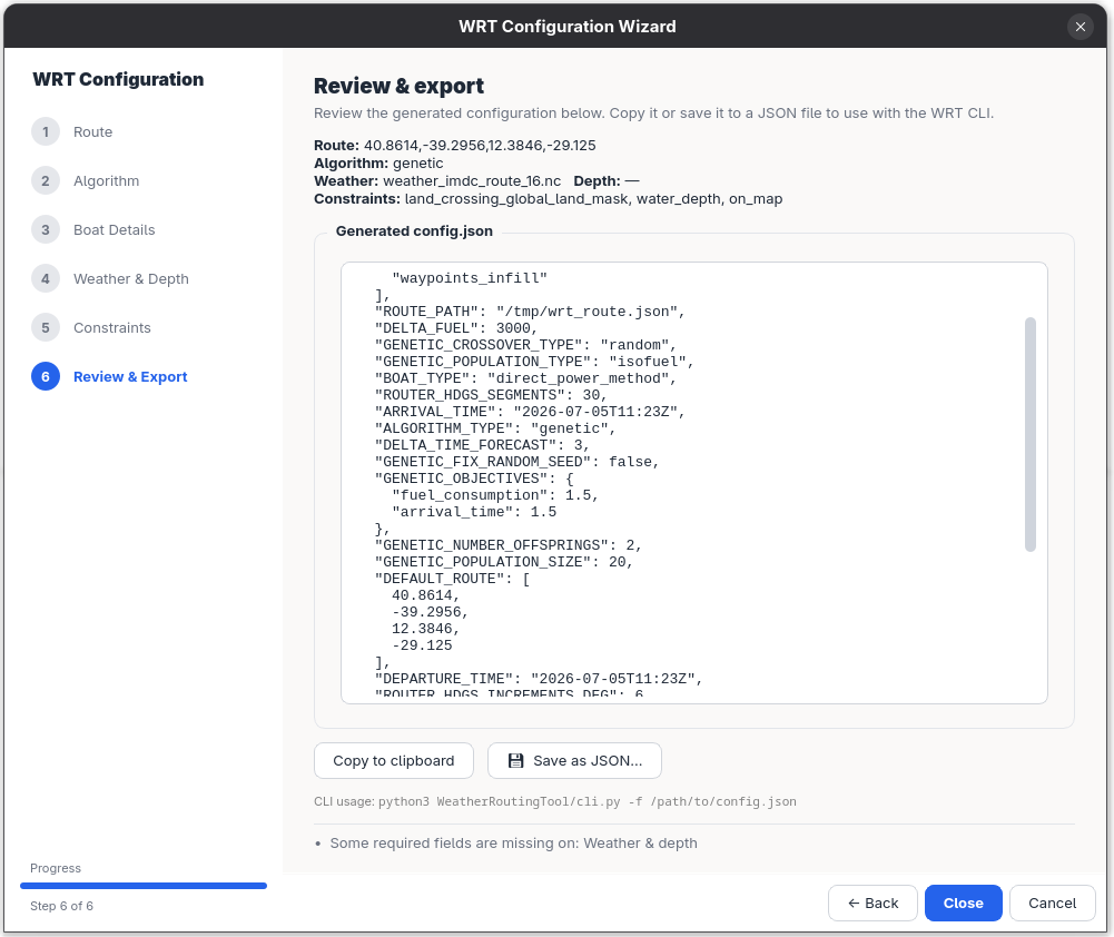
As users progress through the Configuration Wizard, their inputs are automatically translated into a valid WRT configuration. The final review page presents a live JSON preview (refer Figure 5), allowing users to verify the generated configuration before exporting or using it to run the Weather Routing Tool.
Although the wizard is already functional, it remains a work in progress and will continue to evolve based on mentor feedback and usability improvements throughout the remaining GSoC period.
Route Visualization
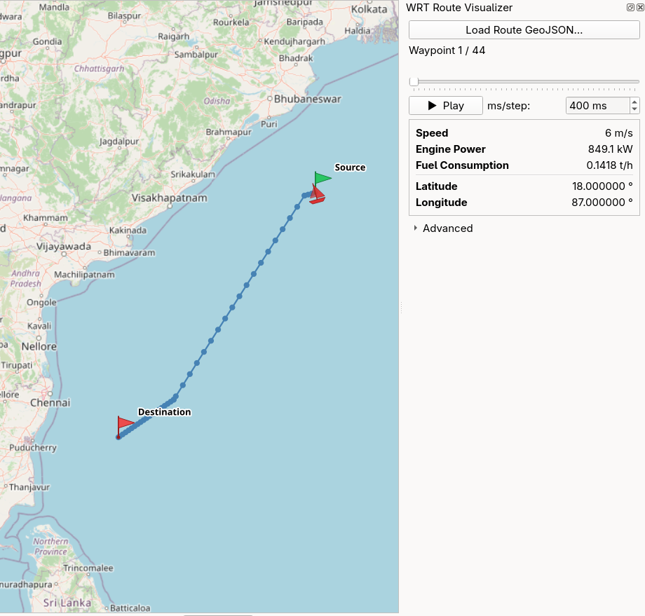
Another major milestone has been integrating route visualization directly into QGIS. Previously, routing outputs needed to be inspected separately. By visualizing routes inside the GIS environment, users can immediately explore routing results alongside other spatial datasets without interrupting their workflow. This creates a smoother user journey, where configuring a route and analyzing the results happen within the same application.
Upcoming Work
The second half of the project will focus on completing the remaining components of the plugin:
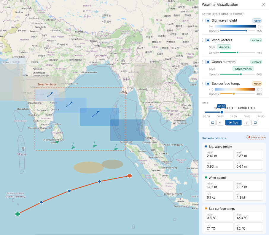
- Interactive weather data visualization (refer Figure 7)
- Temporal weather exploration and layer controls
- Running WRT directly from QGIS
- Testing, documentation, and polishing the overall user experience
Conclusion
The first half of GSoC has been a rewarding experience, allowing me to explore QGIS plugin development while working on improving the usability of the Weather Routing Tool. The progress made so far has established the foundation for a more intuitive workflow, replacing much of the manual configuration process with a guided interface and bringing route visualization directly into QGIS. I’m excited to complete the remaining features and share the final plugin with the community.
References
- WRT-QGIS Plugin Repository (https://github.com/52North/WRT-QGIS)
- Weather Routing Tool Repository (https://github.com/52North/WeatherRoutingTool)
- Weather Routing Tool Documentation (https://52north.github.io/WeatherRoutingTool/)
- QGIS PyQGIS Developer Cookbook (https://docs.qgis.org/latest/en/docs/pyqgis_developer_cookbook/)
- Qt Documentation (https://doc.qt.io/)
These developments took place in connection with the TwinShip project.
 This work has been co-funded by the European Union’s Horizon Europe programme under grant agreement No. 101192583
Leave a Reply