This week I want to show some of small convenience additions in ILWIS 3.8. None of these changes have wide application like for example the animation or 3D features discussed in previous blogs but they add a level of convenience, a level of interactivity that was previously not there. Particularly I want to show
- Filtering on class maps
- ObjectCollections as layer
- Map info pane.
Filtering on Class maps.
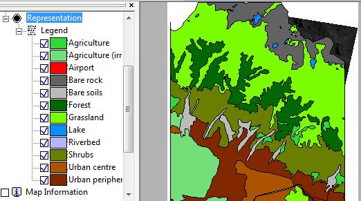
When we display a class map usually we see all the classes. Sometimes though this is not what we need. Suppose I have an image and a class map of the same area and I want to understand the relationship between those two maps better. Each map covers the other so without running an application and filtering out some of the information it is difficult to do. Fortunately in ILWIS 3.8 we can do this quickly by simple “unchecking” class items in the legend tool in the Layer view.
For example, in the cut out below you see a landuse map covering an image of the same region but the polygonmap almost ompletely covers the raster map. In legend of the representation you have the option to check out certain classes
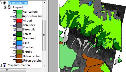
If you for example check out : “Shrubs” and “Urban periphery” the result would look like this:
Nothing earth shattering, simply convenient.
ObjectCollections as Layer
Before 3.8 Object collections where not widely used in ILWIS. Intended as “virtual” folders, a convenient way of grouping your data without needing to create real folders all over your computer, many people found them a bit confusing. They looked too much like folders and could never be found as they were “virtual”. Anyway, in the 3.8 they see more uses. They are already the basis for animations for vector maps but they have other uses too. One of them is using them as a container that is intepreted as one layer in the map window.
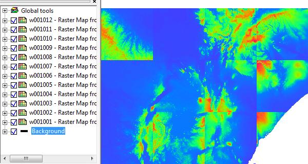
Suppose I have collection of raster maps (value) that cover a large area. If I display them in the map window it could look like
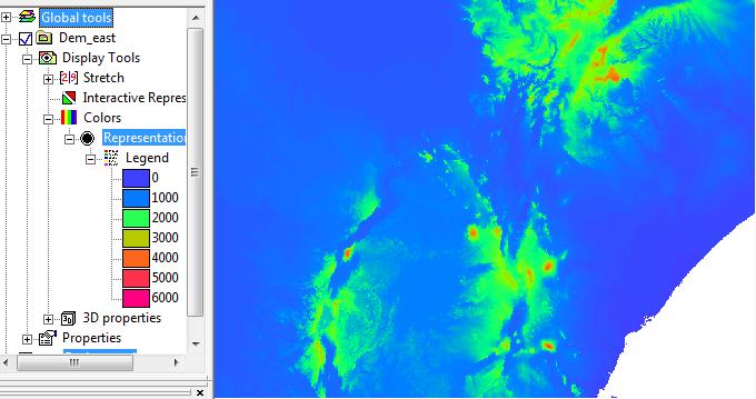
12 maps with all different stretch values (they are independent). You might not see it but this actually a DTM of part of east africa. Due to the different stretch ranges this is almost impossible to recognize. You would have to adjust the stretch range of every individual map to get a decent rendering which is of course annoying. You could glue the maps together but what you don’t know that the actual area in this case is about 22000 x 16000 pixels. Glueing takes a lot of time then.
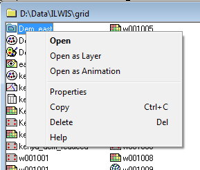
Fortunately I have a more convenient option in 3.8. If I organize these maps in an ObjectCollection I can show them as a single layer. The context menu of the collection will then look like
it has an open as layer options. Using that result would look like :
a correctly stretched, correctly positioned composite of all the maps in the container as a single continous layer. No mosaicing is done. It uses the ability of ILWIS 3.8 to reproject and reposition raster maps on the fly. As far as ILWIS is concerned this one single map though they are actualy still 12 seperate maps. All display tools that work for a single layer should als work for this composite. So things like the profile tool, dynamic representation or dynamic stretching work just fine.
The composite has one limitation, all maps in the collection must have the same domain. This is of course logical as the display tools see it as a single layer and a layer has one domain.
You will not use this option that often but it can be very convenient.
Map Info pane
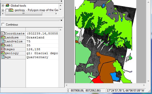
Last I want to briefly show the Map Info pane. Actually this is the “old” pixel info. A very convenient tool that I felt was under utilized previously. It is located (default, you can move it around) at the bottom left and basically shows all the data of a location under the mouse cursor. This includes attribute tables, coordinate information, pixel location etc.. all.
It has a context menu with which you can customize it further. The continous check ensure that you get info dynamically following your mouse (when checked) or that only reports when you left click on the map.
Well, these are just three of the convenience tools. In ILWIS 3.8. There are many others but those have to wait until next blog.
Leave a Reply