Introduction
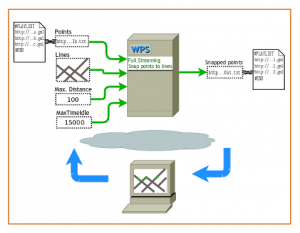
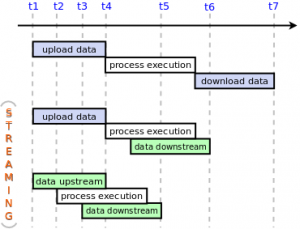
As I mentioned in a previous post (please read it before continuing), I intended to extend the Open Geospatial Consortium (OGC) Web Processing Service (WPS) enabling it to process continuous data streams, as well as to send intermediate results back to the client. These two capabilities are realized with Full Streaming WPS, a new approach that brings near real-time geoprocessing to WPS. In this post, the foundations of such an approach are given, as well as implementation details and pointers to public resources. It also includes a demo.

