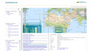
The metadata community has taken two new software projects under its wing: GeoMetaFacet and GEO label Java.
GeoMetaFacet
Find out more on the project website, develop with the source code on GitHub, and try the live demo.
GEO label Java
The GEO label is an interactive visual summary of geospatial metadata to facilitate search and discovery use cases. It generates a visual summary based on standardized metadata documents (ISO19115, FGDC, SensorML, GeoViQua Quality Information Model) and can be easily integrated into any website as an interactive SVG.

Within the research project GeoViQua, members of the metadata community developed a Java-based GEO label server implementation that can generate GEO labels on-the-fly based on metadata documents.
Find out more on the project website, develop with the source code on GitHub, and try the live demo.

Leave a Reply