Authors: Henning Bredel, Sebastian Drost, Benedikt Gräler, Matthes Rieke
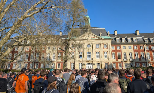
The FOSSGIS 2025 closed its doors a while ago after four full days of presentations, workshops and Birds of a Feather meetings! 727 participants traveled to Münster for the event and 385 followed online. 52°North showcased expertise in various fields, such as Cloud technologies and DevOps, interoperability and data integration, Spatial Data Science with co-design, and provided insight into KomMonitor developments.
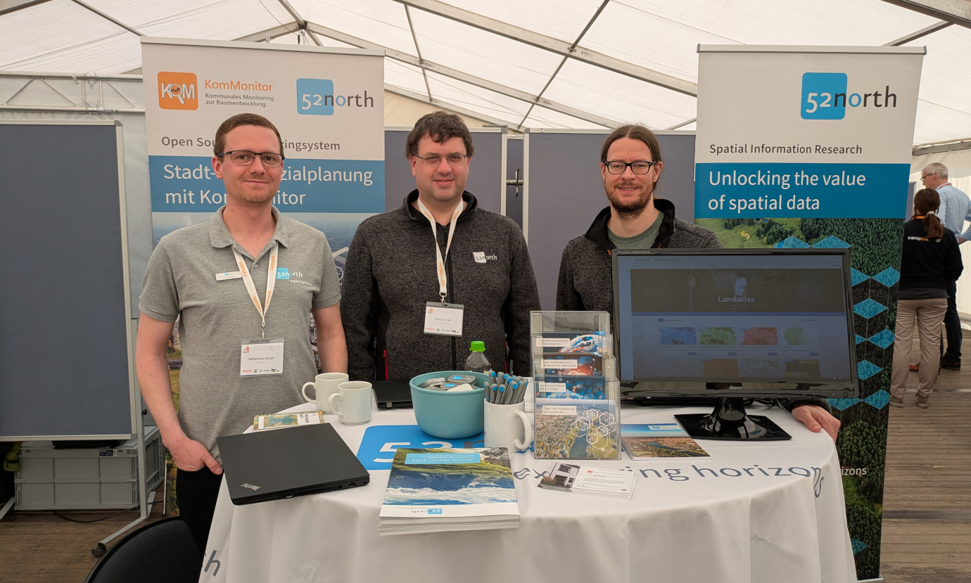
We welcomed many people to our booth, which was located inside a large tent in front of the amazing Münster Castle. It was a pleasure to meet familiar faces again, such as project partners, former employees and students. We also enjoyed conversations with conference attendees, sharing some exciting insights into our projects and daily work. In addition to our standard information material (annual reports, postcards and project flyers), each visitor received a delightful tin of mints. We hope they helped keep a cool head during the conference sessions. Speaking of which, this year’s conference focused on trending topics such as Large Language Models and Urban Digital Twins. Of course, OSM and QGIS enthusiasts could choose from several presentations covering news, tips and tricks, and the latest developments in the open GIS world. Our own presentations contributed to the success and variety of the conference.
Colleagues from con terra and 52°North jointly presented an open source solution to harmonize and integrate open data on flooding events in near real-time. The work was motivated by the insurance industry following the devastating flash flood in the Ahr valley in July 2021, where an urgent need to be better prepared for such events arose. The solution combines open data from flood awareness systems (such as EFAS, GLOFAS) and flood monitoring systems (GFM, EMSR), as well as radar data from the German weather service (DWD). The aim is to ensure the continuous provision of a tailored information product as quickly and automated as possible. The resulting data aggregate contains the classified data sources as well as the raw data and is made available to end customers. The platform pattern implements data streams with extensive processing on a maximally scalable Kubernetes platform. Automated Argo workflows are used to generate a daily information product. The presentation was followed by a couple of questions and is now available at: https://media.ccc.de/v/fossgis2025-57945-automatische-veredelung-von-offenen-nahe-echtzeit-daten.
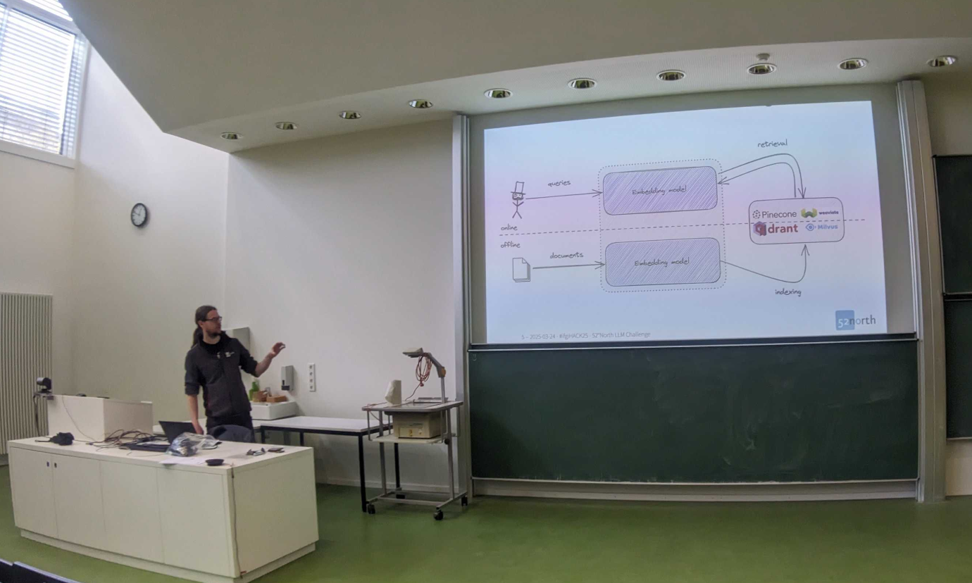
Simeon Wetzel from the Chair of Geoinformatics at the TU Dresden prepared a talk with 52°North’s Matthes Rieke on his work for the 52°North Innovation Prize. He introduced an LLM-based framework designed to improve the searchability of geodata and research data infrastructures, moving beyond the limitations of traditional metadata-based lexical searches. The presentation highlighted the challenges of lexical searches, such as the need for specific terminology and the problems caused by linguistic variations. It also addressed the issue of datasets not meeting user requirements due to insufficient or inaccurate metadata. At the heart of the framework lies a dialogue-oriented search approach that integrates a chatbot for natural language interaction with a semantic search index. The framework is designed to integrate with various open-source language models, offering flexibility. Overall, the presentation showcased a novel method for achieving more accurate and comprehensive geodata discovery. The presentation was well attended, with a full auditorium participating in a lively question-and-answer session at the end.
In addition to the two presentations, 52°North’s Henning Bredel lead a GeoNode Birds of a Feather meeting for the German GeoNode user group. This quarterly gathering, which alternates between remote and face-to-face formats, saw fewer attendees compared to previous years. Many members had already indicated in December that attending FOSSGIS would be challenging. Despite this, the meeting welcomed two new participants interested in GeoNode development.
The session focused on discussing the evolution of the user group, its technical achievements, and an overview of GeoNode’s capabilities. Particular attention was given to GeoNode v5, which is nearing release, including upcoming features and fixes. Due to the lower turnout, the group decided to create a poll to schedule future quarterly meetings rather than setting fixed dates. The next face-to-face meeting is planned for FOSSGIS 2026 in Göttingen.
Complementary to the conference, the Institute for Geoinformatics (ifgi) at the University of Münster and the FOSSGIS e.V. organized a pre-conference, open hackathon ifgiHACK25. The Münster based companies re:edu, con terra, and 52°North responded to an open call by ifgi with challenges that addressed innovative open source solutions in the fields of cycling, the environment and the integration of modern AI methods into open source geo-IT solutions. Students also contributed their own ideas. Over the course of the hackathon, the teams were in touch with the challenge initiators and received feedback regarding the development of their solutions. After 24 hours of intensive work, the groups presented their results to a jury of representatives from the University of Münster, Bochum University of Applied Sciences, the companies and FOSSGIS e.V.. The hackers were then able to present their projects in in five minute pitch sessions at the FOSSGIS conference. All teams were invited to take part in the first day of the conference and the dinner to immerse themselves in the latest open source developments and the geo-IT community.
Leave a Reply