As mentioned in my previous blog post, this project aims to add some new features to the enviroCar Android application. The app already contains features which display a car’s CO2 emission and speed. So in the first phase of my summer of code, I focused on modifying the existing dashboard and localization.more >
Food for thought – 52°North supports Hackathon at ifgi
The Institute for Geoinformatics (ifgi) in Münster celebrated its 20th birthday last week – congratulations!
Several events accompanied the celebrations. First, members of the 52°North company and network had the chance to attend a high quality scientific symposium with guests from all over the world. Participants listened to inspiring talks by leaders in the scientific domain of geoinformatics, several of them former members of ifgi. On the second day, invited guests took part in a “think tank on Geoinformatics” and the summer school for graduate students opened its doors with the topic “Gamifying Spatial Collaboration”. Students from all over the world discussed and learned about location-based gaming and spatial collaboration during the six days. Invited lectureres Barbara Grüter (http://www.gangs-of-bremen.de/) and Peter Kiefer (http://n.ethz.ch/~pekiefer/) spoke on these topics and ifgi PhD students and Post-docs supported their endeavors.
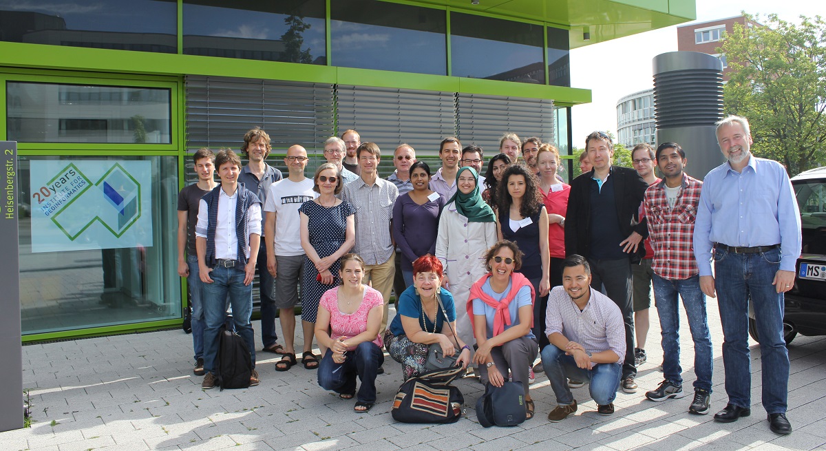
One of the highlights of the summer school was a “hackathon” on Sunday. In the morning, the participants pitched several ideas: a mobile game for measuring emotional state in buildings, a “bet matching” app for spontaneous challenges while on the go, and a mobile game that can be played while driving. The students went for the last option and developed a concept for a location-based in-car game that is not only fun to play and makes your commute more interesting, but encourages players to provide their data to the enviroCar platform. Although the hackathon ended up being a “thinkathon”, the task of designing a completely new game with some bounding conditions was a great experience for the participants. 52°North GmbH supported the hackathon with drinks, sandwiches and snacks, providing energy to fuel the creative ideas that we’ll hopefully hear more about soon.
Sensor Data Access for Rasdaman
Project Description
Currently, the new 52°North SOS version 4.x supports data storage for many different Database Management Systems based on Hibernate, such as Postgres/PostGIS, Oracle/Oracle Spatial, or Microsoft SQL.
This project aims to connect Rasdaman as an alternative data storage backend to the 52°North SOS and explore storing array observations in the SOS. We currently explore the integration process and consider several alternatives:
- create the internal data source representation of the SOS by implementing the 52°North SOS Rasdaman “data access objects”,
- create Rasdaman-Hibernate mappings for 52°North SOS, e.g. by implementing a generic Rasdaman JDBC driver.
enviroCar UX Design
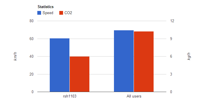
My project deals with the enviroCar Android application. The application connects with your car through an OBD bluetooth adapter and measures CO2 emission, fuel consumption, engine load and several other parameters. The parameters, such as CO2 emission and speed, are plotted in a chart against all the users who also use the enviroCar application. This helps to decide how ‘sustainable’ a driver you are (as shown in the image below). The data collected for a city can be used for showing CO2 hot spots in that city.
- « Previous Page
- 1
- …
- 45
- 46
- 47
- 48
- 49
- …
- 60
- Next Page »