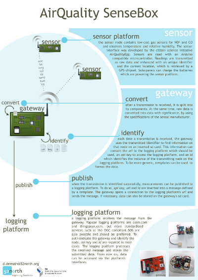
We will appear at AirMonTech Workshop / Conference in Duisburg [GER] from March 04 to March 06 and present our AirQuality SenseBox project. Check out our poster below…
Making Use of Low-Cost Air Quality Sensors
Last year the sensemake.rs community started their AirQuality Monitoring and Sensing project on kickstarter. In september the Institute for GeoInformatics (IfGI) and 52°North held a workshop together with the designers of the platform to discuss further use and evolution of this project (see post). We had the great luck to receive 20 beta devices of the AirQuality Egg.
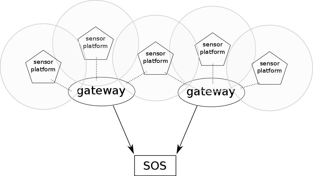
In the last months, we tried to convert the existing approach of “balcony-mounted” devices to a more autonomous solution. Instead of the nanode-rf we connected an RFBee Wireless device (based upon an ATMEGA 168) to the SensorShield. Like the nanode, the RFBee has an Arduino bootloader and can be programmed to fit your needs. The solution we propose is equipped with a GPS receiver to provide a location; a LiPo battery and a solarpanel provide power to the sensor-platform. By adding these components, the AirQuality Egg turns into a sophisticated Wireless Sensor Platform. Data are sent to gateways which forward it into a Sensor Observation Service (SOS).

ArcGIS Server SOS Extension – podcast
As reported earlier, we have implemented an SOS extension for ArcGIS Server as a so-called Server Object Extension (SOE). We have developed this software for the European Environment Agency (EEA) and in support of ESRI Inc.
The ArcGIS Server SOS Extension is compliant with the Sensor Observation Service (SOS) 2.0 standard defined by OGC. Additionally, the SOE provides a new REST interface to sensor resources which complies to the Geoservices REST API developed by ESRI, which is currently going through the standardization process at OGC.
More details on this development (e.g., demo, download link, SVN access, installation instructions, etc.) can be found on the project’s website.
In a recently published interview, Peter Kjeld (EEA), Satish Sankaran (ESRI), and Andreas Wytzisk (52°North) explain this mutual development and further plans with this software.
A detailed illustration of the functionality of the ArcGIS SOS extension is provided by the following screencast:
SOS Importer 0.3.0 Development Version Released
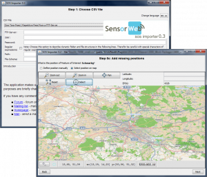
Today, a new version of the SOS (Sensor Observation Service) Importer was released. It is a tool for importing observations from CSV (Character Separated Values) files into a SOS instance using an eight step wizard for guiding a user through the often cumbersome process of data transformation.
Version 0.3 offers the following new features:
- Support more observation types
- Truth
- Count
- FTP Remote File Support
- Fixed bugs: 523, 586, 589, 629, 630, 645, 649, 650, 668, 669, 707, 733, 736, 738
- Use SOSWrapper from OXF 2.0-SNAPSHOT
More details can be found on the Wiki page of the SOS importer.
You can download the binaries from our Maven release repository:
Alternatively, you can build the binary files from the source code.
Feel free to share your experience with the Sensor Web community in our forum or mailing list (choose which you want, they are synchronized ;-)).
- « Previous Page
- 1
- …
- 18
- 19
- 20
- 21
- 22
- …
- 29
- Next Page »

